The MX Moment: Part II
The MX Moment
EXPLORING COLD WAR HISTORY AND DEMOCRATIC FUTURES IN THE NUCLEAR WEST
Part II: Wendover
Aerial Views
As a study in place schizoid border town of Wendover is as interesting an experiment as one might find. Sitting on the artificial boundary between Utah and Nevada, the eastern side of Wendover is a sober scene of dilapidated buildings and decrepit businesses. Move west along Wendover Boulevard however and the setting dramatically changes on the Nevada side of town, where garish hotel casinos have mushroomed as gaming and entertainment has become the primary driver of the Wendover economy. These two faces of Wendover reveal the impermanence of place and the changes on the landscape that can rapidly manifest with flows of people and capital.
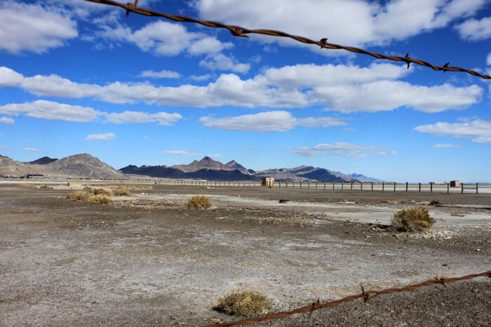
The Wendover airfield lies south of town, the last appendage of the city that reaches out into the vast open Great Salt Lake desert that surrounds the city. The airfield simultaneously stores the history of the place, while offering evidence of its present and future. Haunted buildings in varying states of disrepair surround the airfield, rotting reminders of the role Wendover played in preparing U.S. air forces for the aerial world of bombing that emerged as a critical component of World War II fighting. These war-era buildings are being slowly reclaimed by the desert, however, interspersed among them are newer structures, places built to support the commuter flights that have become a lucrative stream of revenue for Wendover today. For a fraction of the price a comparable Las Vegas trip would cost, gamblers can fly into the city for a weekend of gambling, buffets, and casino-style entertainment. Inside the casinos the neon lights, noise, and general ambiance are nearly indistinguishable from what can be found in other, more expensive, locales.
Wendover was always the first stop we would make on our family summer vacations to Reno. Growing up it was always a way station on the road to somewhere else. On a bitter cold Saturday morning in early November 2011, I make the familiar drive to Wendover again. The Historic Wendover Airfield Foundation has offered a tour that promises to reveal the important role Wendover played in both World War II, and in preparing military forces for the atomic bomb drops over Hiroshima and Nagasaki.
The Interstate 80 road to Wendover offers its own lessons in the complex history and treatment of the Great Basin desert. The highway passes through the heart of the Great Salt Lake desert, among the most distinctive environments on Earth. In an environment full of dusty playas this is the largest and most daunting.
One of the more notable moments of western overland trails history had its roots in the massive expanse of the Great Salt Lake Desert playa. When the Donner-Reed Party left Missouri in May of 1846 they made the unwise decision to deviate from the well-traveled California Trail at Fort Hall, Idaho and instead journeyed along the Great Salt Lake Desert on a route known then as the Hasting Cutoff. Named after its promoter, Lanceford W. Hastings, it was a route that was ill suited for both the party and its heavy cargo. Today deep wagon ruts still mark the northern Great Salt Lake desert over which the Donner-Reed Party traversed. The cutoff delayed the party and by the time they had cleared the southern end of the Ruby Mountains and pushed their way up the eastern flank of the Sierra Nevada’s they found themselves hopelessly snowbound. The acts of cannibalism that took place in the Sierra-Nevada Mountains still serve as a grim cautionary tale underscoring the struggles and risks faced by those engaged in the act of westward expansion.
The mountain ranges and valleys that roll west with Interstate 80 also provide their own insights into the recent history of human activity in the Great Basin. The first mountain range west of Salt Lake City is the Oquirrh Mountains, home to the largest open pit mine on Earth at Bingham. Further west sits the ominously named Skull Valley, which gained attention in the late 1990’s and early 2000’s when members of the Goshute Indian reservation proposed allowing high level nuclear waste storage on their ancestral lands. It was a proposition that effectively divided the tribe between those who looked on their obligations to their ancestral homelands as a sacred duty, and those who rationed that in a desperate economic situation the best opportunity for growth would be through leveraging the one thing the tribe has in abundance: isolated space. Ultimately the project proposal derailed when Utah Governor Mike Leavitt promised to tie up any attempts to move high-level waste on Utah roads in endless litigation.
What was proposed on the Goshute tribal lands is a reality in nearby Clive, Utah where EnergySolutions (and its predecessor, Envirocare) have been processing and storing low-level radioactive waste since 1990. The company has weathered its share of controversies beginning in 1997 when Envirocare founder Khosrow Semnani was forced to resign in the wake of a bribery scandal involving him and regulatory officials from the Utah Division of Radiation control.
When EnergySolutions was born in 2007, after the consolidation of Envirocare and three other waste handling companies, an aggressive advertising campaign was unleashed and countless television and radio ads invited Utah residents to schedule a tour of the facility and learn more about the activities taking place there. Today, EnergySolutions continues to bury low-level waste in the desert, though ongoing controversy over the types of waste they procure, as well as increasingly worthless company stock make the EnergySolutions long-term prospects hazy at best.
A final site worth considering on the road to Wendover is the vast secret space of the Dugway Proving Grounds, which occupies a massive territory south of Skull Valley and Clive. The proving grounds were born on February 6, 1942 when President Franklin Delano Roosevelt withdrew 126,720 acres of public domain from Tooele County. The Dugway Proving Grounds were used during the war as the site upon which mock German and Japanese communities were built (and rebuilt) to test how effectively bombers and their bombs could obliterate place. Between 1945 and 1946 Dugway also served as a temporary prison for 200 German POW’s.
After being considered, and rejected, as the potential home for US atomic domestic testing, the Dugway Proving Grounds instead became home to U.S. military chemical warfare planning and testing. Among the most famous moments from this period came in 1968 when VX nerve agent from Dugway was tested, and accidently dispersed on to Skull Valley. This resulted in the deaths of approximately 6800 sheep being grazed in the valley.
Today the Dugway Proving Grounds serve as the site where U.S. chemical and biological munitions are disposed of once they reach expiration. It is not uncommon to see periodic clouds of smoke burn over desert of Dugway, a haunting reminder of the abuses done not only the desert, but also on the lives that live downwind of such places. The smoke over Dugway attests to a certain belief system and set of assumptions that have looked on America’s deserts as unproductive and worthless. It is attitudes like these that look on military use of western spaces as part of the larger American project, one bent on making all places commodity and useful. Activist Chip Ward captures this twisted logic in his manifesto of citizen activism, Canaries on the Rim, when he asks, “if the Great Plains can be cleared to make the nation’s breadbasket, then why couldn’t the Great Basin become the nation’s wastebasket?” (Ward 57).
The road to Wendover underscores the sense that in a space this massive and open it is almost as if a vacuum is created, a void into which immense cognitive dissonance can grow like a cancer or where imagination can flourish and unfold. Ghosts haunt this landscape, and the road to Wendover offers momentary glimpses of the opening days of the Nuclear West.
Upon arriving at the Wendover Historic Airfield Museum those of us who have signed up for the tour are directed into a small briefing room to discuss the itinerary for the day. We are shown a brief video that gives some idea of the unique history of this place, its explosive growth during World War II, and its subsequent abandonment until gambling helped shape and define its present edges and contours.
The airfield was first established in 1940, when the U.S. Army Air Corp determined that the wide open space, low annual precipitation, and low population density made the Great Salt Lake Desert a perfect location in which to establish bombing and gunnery ranges. The first detachments to the Wendover Air Base arrived in August of 1941 and by March of 1942 it had achieved autonomy as an independent air base, after having previously served as a subunit under Hill Air Force Base in Ogden Utah. During the war years Wendover became the site the many air force pilots perfected their bombing techniques, finding the vast open spaces of the desert an ideal destination to practice the art of war. Among these forces were the pilots and crews of the massive B-29 flying fortresses, including Colonel Paul Tibbets and his crew aboard the Enola Gay.
The explosive growth of the Wendover Air Field is seen in the dramatic demographic shifts of the war years. At its peak in 1943, Wendover was home to approximately 2000 civilians and 17,500 military personnel. This wartime boom is still evident at the Wendover Air Field in the rows of dilapidated bunkers and former support facilities that were essential for sustaining life on the base.
After our early morning briefing the tour groups is divided, and I climb aboard a decommissioned casino shuttle bus, which takes us to our first stop, the former base officers club. When we arrive we are told that it is the latest building on the airfield undergoing restoration. Since the Air Field Museum operates as a non-profit, the restoration work they perform on the facilities here is piecemeal. The desert is slowly reclaiming structures faster than they can be restored, and when they are gone it will be the abandoned artillery shells and bomb debris still littering the nearby desert that will be the last artifacts capable of telling the story of what happened here.
The next stop on the tour is the acreage once dedicated to the barracks and mess hall. It was the mess hall that shows the last visible signs of military use. During the 1980’s the USAF stationed pilots in Wendover to engage in war game scenarios. Squadrons were divided into competing teams, and though the mess hall and cafeteria are now in decay, the insignias of those various groups still illuminate the walls.
The mess halls front door exits onto the property that houses the rapidly decaying barracks that once housed the over 10,000 servicemen who were stationed in Wendover. Uniform and in similar states of disrepair, we are encouraged to wander around and investigate. Two of the buildings are open, one filled with a random assortment of garbage and debris, and the other a functioning exhibit hall for the Center For Land Use Interpretation.
But while these assorted buildings attest to the lives that have passed through Wendover it is the airfield itself that defines this space. In this respect it is appropriate that the most famous historic photograph of Wendover from the World War II era is the aerial view of its two massive runways intersecting one another and creating a grand X on the desert floor. The aerial world was central to the military activities in World War II. As William Fox notes, “our view of the world has been increasingly viewed from the aerial view since World War II – in part because our view of the war was so dominated by aerial imagery.” (Fox 15) The aerial Apollonian view of the world has underwritten the field of cartography since its inception. Advances in both flight and photographic technology found an ideal marriage in the types of activities engage in at Wendover. As Richard Franchavilia has noted:
This apollonian view coincided with simultaneous development of high-resolution cameras and new films that could capture subtleties in the region’s geology, vegetation, and land use. That technology ultimately privileged the public to see what only the imagination once beheld. This is more than simply a privileged view from on high. Rather, it is a kinetic experience by which the map user navigates over the place much as a fighter pilot does. (179)
Another way to approach the importance of what the aerial world of Wendover offers is to consider the bird's-eye view of the world that is accessible today to anyone through Google Maps. It is a view built on the technology of satellites and optics born of military-industrial spending. It runs along an Internet born of computer networking also subsidized by military spending and research. Whether these views dramatically alter our relationship to our planet are open to interpretation, but in considering the myriad ways the technology impacts our lives, the base at Wendover feels like some sort of genesis point.
The sense of the power of the aerial image that has deep roots in Wendover is deepened by the next stop on our tour. Sitting on the northern edge of the airstrip stands a nondescript building that has been given the restoration treatment currently taking place at the officers club. We are told that near the end of the war this building, named the Norden Bombsite Storage, was among the single most guarded locations in the country. The reason was because the top secret bombing run missions and accompanying aerial data maps for numerous atomic targets were stored here, including the fateful aerial maps and coordinates for Hiroshima and Nagasaki.
Today the Norden Bombsite Storage building has fresh coats of paint, and period furniture. Classic pinup girls smile timelessly from 1944-era calendars. Massive bank vaults, which once housed the secure bomb coordinates, now stand open and empty, revealing reinforced concrete interiors. A series of exhibits have been set up that help explain the unique training that the B-52 bombers had to undertake in this desert. They provide examples of the unique training the bomber crews of the Enola Gay and Bockscar (the B-29 that dropped Fatman on Nagasaki) had to undertake in adjusting to the new realities imposed by the bombs. The exhibits show how the pilots and crews learned how to drop the new weapon and then bank quickly and flee the scene before getting blown out of the sky by the resulting blast.
These places, the officers club, barracks, and bombsite building, each attest to the deep history that defines this place. Each speaks to the collective mass of lives that passed through and left marks on the desert. The current rebirth of Wendover as a tourist destination speaks to the malleability of place and how it transitions through time, and how in these transitions things are gained and things are lost. It is a reality that faced Great Basin residents in 1979 when President Carter made the announcement that the U.S. Air Force would pursue building and basing for the MX in the shared space of Utah and Nevada. It is to the potential environmental and social changes that MX would have brought, and the oppositional voices it raised that I now turn.
MX Anxieties
The unprecedented size and scope of the U.S. Air Force’s MX proposal ensured that its future implementation would lead to profound and widespread social changes throughout the Great Basin. The first wave of change would ripple out from the sites around each MX shelter construction area, a project projected to last anywhere from six to nine years. Projections indicated that the project would consume resources at a voracious rate, while also leading to a population boom in Utah and Nevada estimated somewhere between 28,000 to 105,000 workers.
A major selling point of MX for Air Force officials was the limited manpower it would take to maintain and run the system upon completion. Based on the overall size of the MX system, however, that number was still estimated at approximately 14,000 permanent U.S. Air Force employees permanently assigned to the Great Basin. Accordingly, in preparing the MX draft environmental impact statement (EIS) the Air Force did include information on potential permanent basing options.
In the MX EIS one alternate basing option is cited that gained some degree of traction with both Utah Governor Scott Matheson and his counterpart, Nevada Governor Robert List. Known as the split-basing option this scheme called for building a portion of the actual MX weapons system in the valleys of the Great Basin, and another portion outside the region, specifically in an area of geotechnically suitable land in Northern New Mexico and Texas.
From the governor’s perspective the split-basing option held appeal, as it allowed for some of the economic benefit that would come with military spending, without the full brunt of social and environmental consequences that full basing within the Great Basin would bring. But for others, like representatives off the Milford Business Association, split basing was the worst of all worlds, in effect bringing the negative environment and social costs to Utah without any of the sustained long-term economic benefits. This position is clearly articulated in a February 27, 1981 letter from the Milford Business Association to Matheson, which states:
The Milford Business Association and most Southern Utahans, in fact all Utahans who have their head on straight, oppose your consistent efforts to force “split basing” of the MX. Surely you are not so ill advised as to believe that split basing would be in any way beneficial to Utah. Split basing would eliminate the base but few missiles and shelters. Hercules and Thiokol would be the only Utah beneficiaries. Construction employees, most of whom will be imported from out of state, will return home with their paychecks and that is where they will pay their taxes. The Main Operations Base will be the only stable operation from MX except to the large contractors. Without the base, a boom-bust situation will be created which will work to the detriment of Utah.
Ultimately Air Force officials determined that the preferred basing method they would pursue (should MX become a reality) would be one that kept all facilities in the Great Basin (with the permanent basing structures built in Milford, Utah and Coyote Springs, Nevada).
Increasingly dissonant voices rising from small towns (like Wendover) reveal the anxiety over MX that hung over the landscape like a shadow. Yet at the same moment oppositional voices were beginning to articulate their fears, U.S. Air Force planners were engaged in a campaign focused on simultaneously promoting its virtues while obfuscating specifics that could assist in developing an informed position on the issue.
It was obvious that social changes were inevitable in both Utah and Nevada with the massive influx of outside bodies needed to build and maintain the system. The effort would place unprecedented demands on local health, education and law enforcement services).
Of even larger concern for long-term economic practices in the Great Basin was the potential water that the MX would suck a region that was already the most arid section of North America. The small communities as well as farmers and Great Basin ranchers were already found themselves working within decidedly narrow margins when it came to utilizing what scant water flowed into the region. The ongoing claim from the U.S. Air Force was that the federal government would remain beholden to the “first in time, first in right” doctrine that governs much of the water use in the west. Instead, MX planners claimed that a sufficient amount of the water needed would come through groundwater taken from wells dug on federally controlled lands. The potential impacts born of draining groundwater resources and potentially altering the hydrostatic processes in an already fragile desert environment shed light on its own set of technical and environmental concerns that multiple experts would size upon when the time came for official comments on the MX EIS (in early 1981).
The ghost town of barracks and abandoned buildings that surround the Wendover Air Field are just one spot on the map where the remnants of boomtown realities have been writ. In theses altered landscapes there is a reminder of the tremendous costs that come with the type of explosive growth that fundamentally alters the DNA of place. This fear appears in the voices of multiple Utah residents who live on through the MX historic record, each stating a variation of a refrain on the potentially devastating loss of a “certain way of life” that would move into the region with MX construction. Carole Marsh Carter of Alamo, Nevada articulates this position in a letter to U.S. Air Force officials when he writes:
I believe the proposed land-based mode in Nevada and Utah will be obsolete prior to it completion; it is financial sabotage to the nation’s taxpayers; it will ruin cattle and sheep ranching in areas in which it is placed, rendering hundreds of families paupers overnight and seriously affecting livestock markets for other producers as well as consumers; it will cause air and noise pollution and bring endless disturbance to the back country with litter and vandalism; it will bring about excessive use of water and lowering of water tables; it will destroy the habitat of wildlife; it will seriously impair mining activities; it will cause the springing up of cities or military bases we do not want; it will bring people into the areas they do not understand nor care about; it will destroy our valued way of life….”
A similar refrain is heard in the voice of Delta, Utah resident, Marilyn Greenwood who wrote, “Our ‘way of life’ more fragile than the desert, can be destroyed by one simple variable – overpopulation. One surely does not have to wait for a study to know that a monstrous population influx of 25,000 to 75,000 people over the next several years is too great.”
Great Basin residents fearing the change that MX boomtowns would bring didn’t have to look far for other western examples. The energy boomtowns of Rock Springs and Green River in Wyoming, as well as the coal town of Craig, Colorado offer vivid examples of the social costs that can arrive with the type of rapid population explosion that MX promised. For example, a detailed study of Craig, Colorado documents how an 80% population increase between 1973 and 1976 led to a 222% rise in crimes against property, a 600% increase in cases of documented drug abuse, and a 130% rise in child abuse. The same report documents the rise of the Gillette Syndrome in Craig, a recurring feature of other western boomtowns that manifests in dramatically increased divorce rates.
Those who supported MX development took a more optimistic view primarily rooted in the benefits and opportunities potentially born of a larger and more diversified economy. Proponents often pointed to the somewhat similar military buildup that took place across both the Great Plains and the southwest region of Arizona with the construction of both the Minuteman and Titan missile systems. A common assumption underwriting this log was the idea that in the event of a nuclear strike by the Soviet Union on MX all parts of the country would be impacted (either through outright destruction or through eventual exposure to fallout), so in light of such a hard reality some economic advantage should be taken. Utilitarian arguments such as these would run into headlong conflict with emerging arguments for environment and place that would find enhanced articulation with the rise of the MX oppositional movement.
And it is in the unique coalition of disparate voices finding common ground against MX that remains one of the most important legacies of the period. In his analysis of the rhetorical arguments against MX, Matthew Glass has shown how the MX oppositional coalition managed to maintain a firmly consistent front against the Air Forces proposal without ever unifying into one monolithic group with unilateral decision-making authority. The MX opposition was unique in unifying a mixture of voices and opinions from both the rural interior of the Great Basin as well as the larger urban opponents in Salt Lake City, Reno and Las Vegas. The oppositional voice to MX wasn’t monolithic, but rather a guiding set of principles that could find articulation among very different groups, often with other competing interests. In this way environmentalists found common ground with ranchers, Great Basin Indians discovered unexpected similarities with Great Basin religious groups, and the U.S. Air Force was met with a persistent and dynamic opposition that effectively undermined a proposal that it is clear many military officials looked on as mere formality.
In assessing the oppositional movement against MX, it is pivotal to understand the governmental and legal channels that were open and available for broadcasting the diverse articulations against the missile system. Less than one month after President Carter made his MX MPS announcement in September 1979, the wheels of state and local government began spinning in response. A regional government oversight agency named the MX Task Force was immediately established through the Four Corners Regional Commission, and tasked with securing available federal funds for regional MX planning. The members of the MX Task Force included Governor Scott Matheson, Governor Robert List, and FCRC Executive Director, Louis D. Higgs, and it was this three-member board that reserved the right to make unilateral decisions concerning MX within the region.
On November 6, 1979 the bureaucracy of Utah state government expanded to include the state level MX Coordination Office. Tasked with the monumental effort of coordinating all affairs and planning between the various federal, state, and local government offices with an interest in MX, the MX Coordination Office also became the primary hub of contact and MX information for the public. As the realities of an MX future seemed to move closer with enhanced work on the DEIS in early 1980 an additional government agency was born in the form of the regional MX Missile Policy Board. This local government board was comprised of officials from the four counties faced with the largest potential impacts from MX: Beaver, Iron, Cedar, and Juab.
Ultimately the primary job of each layer of Utah’s temporary MX-based government was to coordinate federal activities in the state, often conducted by subcontractors hired by the U.S. Air Force to perform the data gathering that was needed for the eventual environmental impact statement. In addition, the MX Coordination Office early on began planning and coordinating what would ultimately become the network of experts and commentators needed to assess statement and provide Utah’s feedback on its merit and value.
Required by the National Environmental Policy Act (NEPA) of 1970, the environmental impact statement was viewed by both government and opposition members as the crucial moment would decide the fate of MX. It was the one document that was meant to explore all sides of the issue, and in doing so the opposition hoped that the absurdities they viewed in MX would become readily apparent. Through the federal drafting of the environmental impact statement (which took up all of 1980) Governor Matheson repeatedly mentioned that it was the state of Utah’s view that the document wasn’t an “empty gesture” to fill a quota before the “inevitable” emergence of the MX system. This concern voiced by Matheson has its basis in the uneasy relationship between Utah officials and the U.S Air Force that appears to have worsened in the over two years that the MX proposal was debated. Records from the MX Coordination Office reveal the fault lines of these tensions, most often rooted in a growing belief on the part of Utah government officials that the U.S. Air Force was failing to act in good faith, both in its data gathering methods, as well as in keeping state officials appraised of EIS specifics and progress.
The environmental impact statement drafting process also reveals a crucial moment for the opposition, and the vital and needed role of informed debate and discourse in participatory democracy. As per the terms established by both NEPA and the Council on Environmental Quality the U.S. Air Force was obligated to hold public hearings in late 1979 and early 1980 to allow for public comment on the potential scope of the MX EIS. These hearings were meant to provide the opportunity for multiple voices and opinions to inform the debate.
The hearings also served as one avenue for like-minded community members to come together on the issue, in effect creating a web of local opposition to MX that would crisscross the entire Great Basin. However, the public hearings were not free from controversy, as Air Force officials were routinely criticized at each stop for their attempts to manage the debates, both through holding public hearings at odd hours, as well as in not allowing all who attended a chance to register their comments on the record. These actions prompted Governor Matheson to call for additional meetings throughout the state that he would personally attend. This was an early moment of Governor Matheson taking the side of Utah’s citizens and potentially prompting the traceable change in his formal position on MX.
With the release of the MX EIS in early 1981, the public was again given an opportunity to participate and voice opinion on the MX proposal as a matter of public record. By the time the environmental impact statement was released, the MX issue had moved from the realm of local news to national, thanks in large part to a Bill Moyers hosted debate on MX held in Salt Lake City in April 1980. And unlike the scoping hearings that had taken place over a year earlier, MX oppositional voices had spent over a year honing their arguments and working tirelessly to broadcast them across the Great Basin region. The success of the MX opposition is a potent reminder of the demands of a vibrant and active democracy. It is also a heartening moment that reveals how a collection of underfunded oppositional voices moving in unison were able to successfully contend through public discourse with a vast federal apparatus sporting more funds, greater resources, and a presumed national security imperative.
Today the Great Basin communities that would have been irrevocably altered by MX remain largely the unchanged, experiencing the mild and moderate surges of growth that are felt more uniformly throughout all of the west. And in the spaces between these communities the abandoned buildings and ruins of former mining towns like Rhyolite, or former military centers like Wendover provide vivid examples of what growth looks like on the landscape, and the profound implications it holds for fundamentally changing place.
The debate over MX also serves as a crucial reminder of the numerous voices and worldviews that are consistently defining space, and arguing over its borders. Returning to the airfield at Wendover provides an opportunity to see this dynamic exchange take place in real time, and contemplate the value of multiple points of view in setting public policy decisions.
Sharing Space
After returning to the Wendover Historic Airfield Museum for lunch, the itinerary for the second half of the day is laid out to us. The briefing room that now serves as our temporary dining area contains a wall length aerial map of the western U.S., an oversized reminder of the aerial world that was perfected here.
Before we are led back outside the group is ushered into a back office of the museum to see an artifact that is meant to set the tone for the remainder of our visit. It is a replica of the Little Man bomb that was dropped on Hiroshima, complete with signatures from Paul Tibbets and the rest of the Enola Gay crew. Our tour guide explains the intricacies of the bomb design and shows us the laborious procedures involved with successfully arming it in flight. The bomb casing and the veritable shrine to the Enola Gay present in photographs of the plane and its crew reflect something of the narrative that the Historic Wendover Air Museum is attempting to construct and convey. It is one that sees the activity that took place in this dusty desert as necessary, and perhaps inspired. These mementos always do a successful job of reminding our group that while the majority of operations that have taken place in Wendover supported the type of Air Force activity one might find elsewhere, its historic legacy is firmly rooted in the role it played in helping the bomb take flight.
From the museum headquarters we are taken back outside. In spite of the bright sunlight and clear blue sky, the temperature hasn’t budged from the early morning hours. Climbing aboard the decommissioned casino tour van we turn toward the east side of the airfield, in the direction of a massive hangar that appears to have had some restorative work done to its exterior. The outside of the hangar has fresh siding and paint, as well as new windows. We are told that the major mission of the museum is to finish a complete restoration on this structure and ultimately make it the crown jewel of the Wendover Airfield Museum. Superior craftsmanship that has so far withstood the tests of time and environment still allow one individual to roll back the massive wooden bay doors which open onto an overwhelmingly empty warehouse space. The doors were designed to accommodate the massive wings of the B-52 flying fortress, and it is this hangar that was once home to the Enola Gay. We are told that the ultimate hope of the museum staff is to get the hangar restored to the point that the Enola Gay, which is currently in the Smithsonian, could return for an exhibition.
The mission objectives of the Wendover Historic Airfield Foundation appear analogous to those espoused at the museum sites in Los Alamos. At both sites the technical and scientific achievements of the bomb are celebrated, and the more difficult moral questions nuclear weapons raise are largely ignored. A feeling of perpetual celebration for U.S. military personnel and their activity during World War II remains a common thread throughout all of the sites administered by the Wendover Historic Airfield Museum.
Interestingly, the narrative being driven by the Wendover Historic Airfield Foundation isn’t the only one being offered in this space. South of the hangar that once housed the Enola Gay stand a series of buildings in which the dummy bombs used in the B-29 flying runs over the Great Salt Lake Desert were built. Today the Airfield Museum shares this space with the Los Angeles based non-profit, Center for Land Use Interpretation (CLUI). And whereas the Airfield Museum is engaged in active preservation and interpretive efforts to preserve a lone slice of Wendover’s history, the CLUI scope is dramatically different:
The Center for Land Use Interpretation is a research and education organization interested in understanding the nature and extent of human interaction with the earth’s surface, and in finding new meanings in the intentional and incidental forms that we individually and collectively create. We believe that the manmade landscape is a cultural inscription that can be read to better understand who we are, and what we are doing
In the buildings that once built the dummy bombs that mimicked the designs coming out of Los Alamos, CLUI now allows visiting scholars to take up residence and work on various projects targeted at considering the vast Great Salt Lake Desert and assess the “activities it inspires, and what it might represent on a local, national, global, and theoretical level.”
Ultimately the simultaneous visions of the space at Wendover aren’t competing with one another, but rather manage to coexist within a shared space for which each institutional leadership has vary different vision. This speaks to the power place has in offering competing views to those who look on it. It is in these varied views where participatory forms of democracy will help be established. Moving south, the next journey encounters a place that is so staggeringly surreal that it demands new ways of connecting with the landscape, and new words and ideas for describing one haunting potential for place in an uncertain nuclear world.
Sources
Blanthorn, Ouida. A History of Tooele County. Salt Lake City: Utah State Historical Society, 1998.
CLUI.org. 2012. About the Center. http://www.clui.org/section/about-center. Website Accessed 19 Nov. 2012.
CLUI.org. 2012. Residence Program. http://www.clui.org/section/residence-program. Website Accessed 19 Nov. 2012.
Francaviglia, Richard V. Mapping and Imagination in the Great Basin: A Cartographic History. Reno: University of Nevada Press, 2005.
Glass, Matthew. Citizens Against the MX: Public Languages in the Nuclear Age. Chicago: University of Illinois Press, 1993.
In March 2012, I attempted to secure a tour of EnergySolutions but was told by Community Relations Specialist, Lynne Rasmussen that the dates I requested were unavailable and that the two-person group I proposed didn’t fit their minimum group requirement of at least six.
Turse, Nick. The Complex: How the Military Invades Our Everyday Lives. New York: Metropolitan Books, 2008.
Utah State Archives and Records Service, Governor (1977-1985: Matheson), MX missile records, series 1646
Utah State Archives and Records Service, MX Missile Policy Board, Administrative records, series 5643.
Utah State Archives and Records Service, Department of Environmental Quality: Division of Radiation Control, Administrative records, series 16841.
Vanderbilt, Tom. Survival City: Adventures Among the Ruins of Atomic America. Chicago: the University of Chicago Press, 2002.
Ward, Chip. Canaries on the Rim: Living Downwind in the West. New York: Verso, 1999.